Nong Khiaw
Phongsali Province
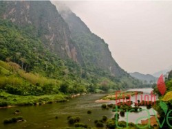
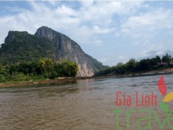
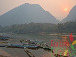
Nam Ou River Muong Khoi Phongsaly Province is one of the remotest of the Lao PDR Provinces, and is dominated by rugged, mountainous terrain and an abundance of thick forests and fast-flowing rivers. It is inhabited by 25 different ethnic groups, each with their own culture, traditions, costumes, and languages. Most of the land is between 500 and 1,500 meters elevation, which moderates the heat of the surrounding areas of Southeast Asia and makes the climate more suitable for trekking and other physical activities. The forests contain an abundance of animal, bird, insect and plant life, and there are certainly many undiscovered species, new to science. The population with 13 minority ethnic groups: Khammu, Tai Dam, Thai daeng, Yao, Leu, Hor, Hmong, Akha, Yang, Bid, Lolo and others. Each minority ethnic group has their own identity, language and culture such as wedding ceremonies, handicrafts, silver wares and jewelry. Boun Neua and Boun Tai are thriving little market towns, and now do a lot of trade with nearby Yunnan Province, China. Mouang Khoa is a small river port on the picturesque Nam Ou River. Phongsaly town is more hill station with cooler climate and centre for trekking to the surrounding areas. All of these small towns have guesthouses and small hotels which welcome both international and local visitors. Attractions: Boat trip on Nam Ou River The Nam Ou River, which starts on the China border, drains all of Phongsali province and flows down through western Luang Phabang province to meet the Mekong above Luang Phabang, is just such a place. Much of the Phongsali province watershed is devoid of roads and still well covered with old-growth forests, and the river and its many tributaries remain in many ways as they were when nineteenth-century French explorers passed through. An important Mekong tributary, the Nam Ou holds a cherished place in Lao lore as the original route followed by Luang Phabang’s founding father, Khun Lo, and later by Fa Ngum, the warrior-king, as he headed towards Luang Phabang to claim the throne and found the Kingdom of a Million Elephants. The river begins its journey in the southern flanks of the mountains separating Laos and Yunnan in China. This northernmost part of Laos, Phongsali province, is hemmed in by high mountains on three sides, and the Nam Ou is joined by no less than eight major tributaries before entering Luang Phabang province and beginning its final run down to the Mekong. Two of these tributaries, the Nam Khang and the Nam Houn, pass within the huge Phou Den Din NBCA, along the border with Vietnam. The southern leg of the journey is the six-hour ride between Luang Phabang and Nong Khiaw which is wildly scenic, especially the karst forests around Nong Khiaw and Muang Ngoi. Closer to Louang Phabang, where the river follows Route 13, extensive logging and slash-and-burn agriculture have stripped the surrounding mountains: only where the slopes are too rocky or too steep for cultivation have stands of forest been left intact. In an effort at reforestation, however, rows of young teak trees, recognizable by their enormous leaves, have been planted. After the road leaves the river, the scenery takes a turn for the spectacular, with vertical limestone peaks and pristine little white-sand beaches. Upriver from Nong Khiaw the scenery continues to impress, possibly even surpassing that of the stretch below Nong Khiaw, the river snaking through impenetrable jungle. Because many of the surrounding mountains are simply too steep for slash-and-burn agriculture, the forests have been left virtually untouched. When the river is not too high and fast, this leg is also blessed with shelves of squeaky-clean beach, perfect for taking a lazy swim and admiring the dramatic scenery. However, this primeval landscape lasts only a third of the distance to Muang Khoua and is then replaced by arable hills with a beaten, domesticated air about them. The journey between Nong Khiaw and Muang Khoua takes approximately five hours. Beyond Muang Khoua, it’s another 100km to Hat Sa, the last town of any size on the Nam Ou until U Thai, far to the northeast. The mountainous scenery on the Muang Khoua– Hat Sa leg doesn’t rival the stretch of river on either side of Nong Khiaw, the slopes having long ago been cleared, cultivated and left fallow. Though gracefully drooping thickets of bamboo have replaced the old-growth forest, here and there a solitary behemoth survives, conveying some idea of the majestic heights that the now-vanished canopy must once have reached. Nong Khiaw Resting at the foot of a striking red-faced cliff, amid towering blue-green limestone escarpments, the dusty town of NONG KHIAW on the banks of the Nam Ou River lies smack in the middle of some of the most dramatic scenery in Indochina. Muang Khoua Located on the left bank of the Nam Ou where Route 4 crosses the river on its way to Vietnam, MUANG KHOUA is an important crossroads and outpost in southern Phongsali province. The town itself is built on a steep hillside where the Nam Phak river enters the Nam Ou, and is named for an ancient rust-clad suspension bridge which connects Muang Khoua with the village of Natun. A stroll out onto the high, swaying structure is worth it for the view, but is a stomach-fluttering experience and not for the vertigo-prone. The area around Muang Khoua is rugged and hilly, but the surrounding hills have been clear-cut and are covered in bamboo and secondary growth. Muang Ngoi Tiny MUANG NGOI on the right bank of the Nam Ou has already surpassed larger Nong Khiaw and Muang Khoua in popularity and is attracting lots of travelers, many of whom are lulled into staying a week or more. Located an hour’s boat ride north of Nong Khiaw, Muang Ngoi is a totally idyllic and friendly village set among spectacular scenery. The fact that it can only be reached by river gives it an edge-of-the-world feel. Although it’s easy enough to just hang out in the village sipping coffee and swinging in a hammock, there are a lot of activities to pursue here, including trekking with the local guide to hill-tribe villages, canoeing on the river, organized fishing trips, making outings to the caves and waterfall and just generally exploring on the islands and beaches on either side of the river. The scenery is superb, easily rivalling Vang Viang’s. Hat Sa The village of HAT SA consists of barely sixty homes, most of which are constructed from the ubiquitous bamboo and palm thatch, although concrete construction has reached even this remote outpost. Most travelers bypass Hat Sa since they’re either in a hurry to start downriver or they’ve come up from Nong Khiaw and have already had their fill of rustic riverside accommodation. But for those looking to experience the trials, hardships and romance that greeted wayfarers of yesteryear, Hat Sa and the villages further up the Nam Ou are about as far off the beaten track as you can get and are worth exploring, especially if you find Nong Khiaw and Muang Ngoi too touristy.


