Lao Geography
Laos Geography
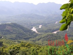
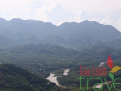
Lao Geography Lao Geography The Lao P.D.R. is located in the heart of the Indochina Peninsula in Southeast Asia. It lies between latitude 14 to 23 degrees North and longitude 100 to 108 degrees East. Laos is bounded to the north by China, to the Northeast and east by Vietnam, to the south by Cambodia, to the west by Thailand, and to the northwest by Myanmar (Burma). Its location has often made it a buffer between more powerful neighboring states, as well as a crossroads for trade and communication. Most of the western border of Laos is demarcated by the Mekong River, which is an important artery for transportation. The Khong falls at the southern end of the country prevent access to the sea, but cargo boats travel along the entire length of the Mekong in Laos during most of the year. Smaller power boats and pirogues provide an important means of transportation on many of the tributaries of the Mekong. The Mekong has thus not been an obstacle but a facilitator for communication, and the similarities between Laos and northeast Thai society–same people, same language–reflect the close contact that has existed across the river for centuries. Also, many Laotians living in the Mekong Valley have relatives and friends in Thailand. Prior to the twentieth century, Laotian kingdoms and principalities encompassed areas on both sides of the Mekong, and Thai control in the late nineteenth century extended to the left bank. Although the Mekong was established as a border by French colonial forces, travel from one side to the other has been significantly limited only since the establishment of the Lao People’s Democratic Republic (LPDR) in 1975. The eastern border with Vietnam extends for 2,130 kilometers, mostly along the crest of the Annamite Chain, and serves as a physical barrier between the Chinese-influenced culture of Vietnam and the Indianized states of Laos and Thailand. These mountains are sparsely populated by tribal minorities who traditionally have not acknowledged the border with Vietnam any more than lowland Lao have been constrained by the 1,754-kilometer Mekong River border with Thailand. Thus, ethnic minority populations are found on both the Laotian and Vietnamese sides of the frontier. Because of their relative isolation, contact between these groups and lowland Lao has been mostly confined to trading. Laos shares its short – only 541 kilometers-southern border with Cambodia, and ancient Khmer ruins at Wat Pho and other southern locations attest to the long history of contact between the Lao and the Khmer. In the north, the country is bounded by a mountainous 423-kilometer border with China and shares the 235-kilometer-long Mekong River border with Burma. With a total area of 236,800 square kilometers, around 70% of Laos’ terrain is mountainous, reaching a maximum elevation of 2,820 meters in Xieng Khouang Province. The landscapes of northern Laos and the regions adjacent to Vietnam, in particular, are dominated by rough mountains. The mountains and plateaus make up three-quarters of the total area. High mountains rising to an average height of 1,500 meters dominate the Northern region. The three highest mountains in the country are all located in the Phou Ane Plateau in Xieng Khouang Province. They are Phou Bia at 2,820 meters, Phou Xao at 2,690 meters and Phou Xamxum at 2,620 meters. The Phou Luang (Annamite Range) stretches from Southeast on the Phouane Plateau down to the Cambodian border; the others are the Nakai Plateau in Khammouane Province and the Bolaven Plateau in Southern Laos, which is over 1,000 meters above sea level. The plain region consists of large and small plain areas distributed along the Mekong River. The Vientiane Plain, the largest, is situated on the lower reaches of the Nam Ngum River. The Savannakhet Plain is situated on the lower reaches of the Sebangfai River and Sebanghieng River, while the Champasack Plain on the Mekong River stretches out to the Thai and Cambodian borders. Blessed with rich and fertile soil, these plains represent one quarter of the total area known as the granaries of the country. The Lao PDR is criss-crossed with a myriad of rivers and streams. The largest is the Mekong River, which is the main geographical feature in the west and, in fact, forms a natural border with Thailand in some areas. The Mekong flows through nearly 1,900 kilometers of Lao territory and shapes much of the lifestyle of the people of Laos. In the South the Mekong reaches a breadth of 20 kilometers, creating an area with thousands of islands.


